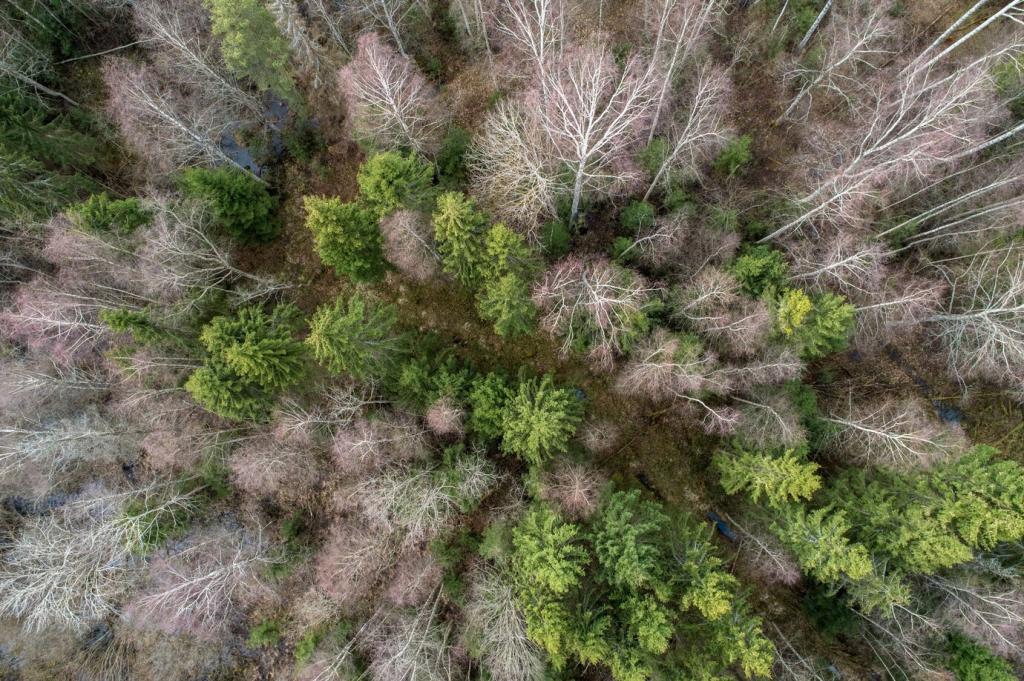
Monitoring Deforestation with Drone Technology

Chosen theme: Monitoring Deforestation with Drone Technology. Explore how aerial robotics, multispectral imaging, and AI‑driven analysis help us detect forest loss faster, safer, and more transparently—and how your voice, observations, and questions can guide our next missions.

Why Drones Are Transforming Forest Protection

High‑resolution imagery captured at low altitude shrinks detection timelines from months to hours, revealing clandestine clearings before satellite passes update. Faster awareness means earlier intervention, fewer trees lost, and better accountability for illegal operators working under canopy cover.

Why Drones Are Transforming Forest Protection

Multispectral bands reveal plant stress weeks before visible canopy thinning. By measuring reflectance in red‑edge and near‑infrared, drones flag subtle physiological changes hinting at encroachment, logging road preparation, or drought vulnerabilities along margins, concessions, and supposedly protected buffer zones.
Tools of the Trade: Drones, Sensors, and Payloads

01
Multirotors hover precisely under tangled canopies and launch from tiny clearings, ideal for targeted monitoring. Fixed‑wing drones cover vast concessions efficiently, returning wide mosaics. Hybrid VTOL platforms blend both strengths where terrain is rugged, access is difficult, and endurance truly matters.
02
RGB sensors document evidence clearly, but multispectral cameras calculate NDVI, NDRE, and SAVI to quantify vegetation health. LiDAR penetrates gaps to model canopy height and biomass. Thermal payloads spot night activity near illegal kilns, camps, and new roads hidden beneath cover.
03
Weather‑sealed airframes, redundant compasses, and hot‑swappable batteries keep missions reliable far from base. Pack extra props, silica gel, desiccant packs, and field chargers. Share your go‑to loadout in the comments so we can curate a community‑tested forest gear checklist.

Turning Pixels into Proof: Data Processing and AI

Photogrammetry and Ground Control That Matter

Accurate orthomosaics depend on thoughtful flight planning, strong overlap, and ground control. RTK or PPK corrections tighten geolocation to centimeter levels. With careful lens calibration, your maps stand up in courtrooms, policy briefings, and peer review without crumbling under scrutiny.

Change Detection with ML Models

Machine learning models classify bare soil, canopy, and skid trails, comparing temporal mosaics to highlight suspicious change. U‑Net, random forest, and gradient boosting excel when datasets include seasonal variation. Contribute annotated tiles to boost recall while minimizing destabilizing false positives.

Open Data for Collective Oversight

Publishing tiles through open platforms invites local validation and constructive critique. When communities see forests from above, guardianship strengthens. Subscribe for dataset drops, and help tag ambiguous areas so alert thresholds reflect lived realities rather than distant, one‑size‑fits‑all assumptions.
Permits, data privacy, and cultural protocols are nonnegotiable. Coordinate with indigenous councils, wildlife agencies, and park managers before flights. Schedule routes to avoid nesting seasons and sacred sites. Share how your team builds trust and safeguards dignity alongside conservation outcomes.

Fieldcraft: Flying Responsibly and Safely in Forests

On a humid dawn in the Amazon, a ranger named Celia launched a small quad above misted canopy. Minutes later, a faint grid of fresh stumps appeared. Those coordinates redirected patrols, halting expansion before chainsaws claimed another irreplaceable hectare.

Stories from the Treeline: Real‑world Impact

In Borneo, villagers mapped peatland edges using a shared fixed‑wing. When the mosaic exposed a covert drainage ditch, dialogue replaced confrontation. Officials agreed to block the channel, and families celebrated as water rose, saving fish nurseries and future harvests.

Stories from the Treeline: Real‑world Impact

Get Involved: Skills, Tools, and Next Steps

Start with open tools like QGIS, OpenDroneMap, and WhiteboxTools. Pair them with free courses on flight planning, safety, and geospatial basics. Join our GitHub for workflows, datasets, and issues you can tackle as a pilot, coder, or mapper.

Get Involved: Skills, Tools, and Next Steps

Local NGOs and forest guardians need pilots and analysts. Offer weekend flights, processing support, or training sessions. Comment with your region, skills, and availability, and we will connect volunteers with projects that respect communities and deliver measurable conservation impact.
Azletip
Privacy Overview

This website uses cookies so that we can provide you with the best user experience possible. Cookie information is stored in your browser and performs functions such as recognising you when you return to our website and helping our team to understand which sections of the website you find most interesting and useful.